I’m hooked. Drawn in like a moth to light (after all, it is called the Range of Light). In just ten days California’s Eastern Sierra became my favorite mountain range in the lower 48, and I can’t wait to go back.
I could wax philosophical about the spirituality of traveling in the mountains, or fill this entire article with overused quotes from John Muir about the region he dedicated his life to. But the joy I remember from my time on the East Side last spring is so pure, just the simple pleasures of slowly climbing a snowy mountain to slide back down again, I want to keep this simple too.
My friend Wade and I started talking early in the winter about taking a ski mountaineering trip somewhere in the American west during the latter half of April, after his season as a ski patroller ended. We decided to stay flexible, watch conditions, and go wherever the snow was good. As winter progressed to spring most of the west, including our home stomping grounds in the Wasatch, had been blessed with copious snowfall. With many options for good skiing available we needed a reason to pick one. Wade had spent part of his childhood in Mammoth Lakes, but had never left the boundaries of the ski resort there. The only time that I had spent in the mountains near there had been a couple fall climbing trips to Yosemite. The Sierra sounded like as good a choice as any.
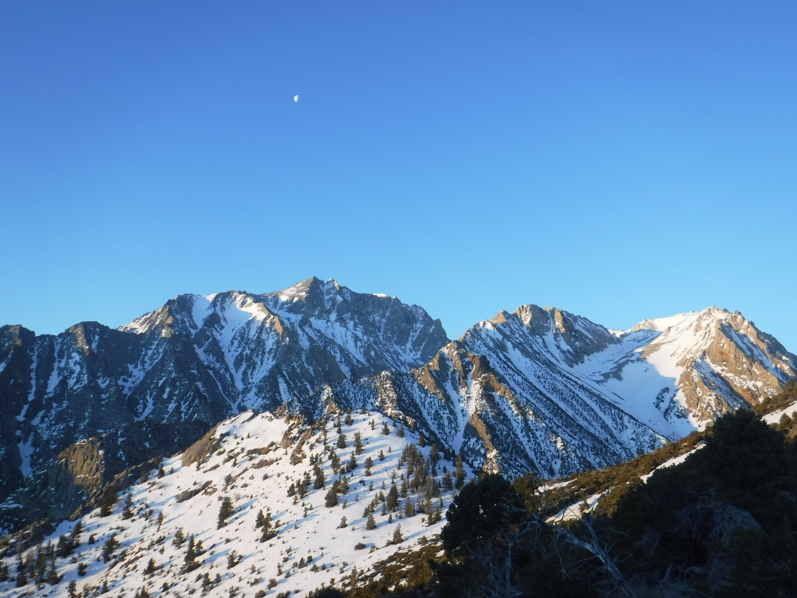
Driving into the Owens Valley from the northeast, I was immediately happy with our decision. Driving south on highway 6 and then 395 I could barely keep my eyes on the road. The highest peaks rose over 10,000 feet above me in dramatic fashion. Craggy ridgelines and steep rock faces were split by snow-filled couloirs and cirques that offered a lifetime of skiing in just what was visible from my van. By the time I met up with Wade at the park in Lone Pine I couldn’t do anything but babble about how excited I was for our trip.
Not having spent time in these mountains before, and with so much available skiing, we weren’t exactly sure how to choose which objectives to focus on. For guidance we turned to the famous (or infamous?) 50 Classic Ski Descents of North America. The book includes four ski descents in the Eastern Sierra and, despite the dig that these are often the “50 classically crowded ski descents,” we figured it would be a good place to start. That put the Mountaineer’s Route on Mt. Whitney, the East Couloir on Split Mountain, Giant Steps on Mt. Williamson, and the Bloody Couloir on Bloody Mountain on our list.
We also recognized that committing to any of these as our first objective seemed a little ambitious, and that we wanted to take on something a little less committing to get a sense for the snow conditions on our first day. Consulting our shiny new guidebook we selected the East Couloir of Lone Pine Peak. It still looked like a proud line but with a little less elevation gain and, maybe most importantly, less of a feeling of commitment to summiting from us.

East Couloir, Lone Pine Peak
We left the trailhead just as the first hints of alpenglow kissed the mountains above us. For the first mile of the approach we walked on a 4X4 road, then through open pinion and juniper forest. Eventually we started to traverse into the canyon, heeding the dire warning in the guidebook and staying high on the north side of the valley, rather than dropping down to the creek. The guidebook seemed to be right about staying above the creek, as it appeared to be steep, narrow, and choked with tamarisk. But staying high was no picnic. On our traverse we frequently gained and lost elevation to avoid cliff bands, and often found ourselves ankle deep in kitty litter sand. Pushing on, we arrived at snow in the bottom of the canyon about 2.5 hours after starting.
As we transitioned to skins we assessed our objective for the day. It started as a low angle, winding gully near our current location, gradually steepened into a wide bowl, then disappeared just below the summit where we knew that it would dogleg to climber’s right and narrow into a couloir. The snow down low seemed to be well into a corn cycle, with a solid refreeze the night before. Our collective mood leapt as we left the kitty litter bushwhacking behind and started skinning towards the summit.
The climb was about as straightforward as possible. We skinned for about 2000’ then switched to crampons for the remaining 3000’ to the top. The snow slowly softened in the sun, yet remained stable and seemed to promise fantastic skiing to come.
On the summit we found ourselves positioned just south of Mount Whitney, with the Sierra Crest sprawling out of view to the north. We admired the view while basking in the sun, sharing snacks, and taking our time to transition. Eventually we skied back to the top of the couloir and dropped in. The couloir cut through Lone Pine Peak’s rocky headwall at just over 40 degrees, before spilling into the top of a large bowl that continued another few thousand feet to the canyon bottom. Our skis sliced the snow like butter, and we railed fast GS turns all the way until the snow ran out.
Getting out of the canyon didn’t feel quite as bad as getting in, partially because we were so happy with how good our first ski day in the Sierra had been and partially because we found a slightly easier route. We were back at the trailhead a couple hours later.
For most of the trip we decided to adopt a day on, day off schedule, as for us it seemed unsustainable to try to link these objectives back to back. After enjoying a rest day that involved some sport climbing in the Alabama Hills and slacklining in the Lone Pine park, we found ourselves packing by headlamp for the Mountaineer’s Route on Mt. Whitney.
Mountaineer’s Route, Mt. Whitney
The road hadn’t opened to Whitney Portal for the season, with the first “soft” road closure about two miles and 1800’ lower than the summer trailhead. We had walked for about ten minutes from that first road closure when we noticed a couple trucks coming up the road behind us. They had decided to ignore the closure sign, and let us ride in one of their truck beds until they reached a “hard” closure gate a mile up the road. Without a place to park they drove back down to the first closure, but we were grateful for the ~45 minutes of walking that they saved us.
The Mountaineer’s Route faces due east and has steep rock walls on both sides. In planning our day we had failed to consider that the snow in the couloir would warm for a few hours in the morning, only to refreeze around midday when the sun shifted south and was blocked by the southern wall of the chute. As we were climbing the east facing portion of the route we noted that the snow was already refreezing; not a good sign for conditions on the descent.
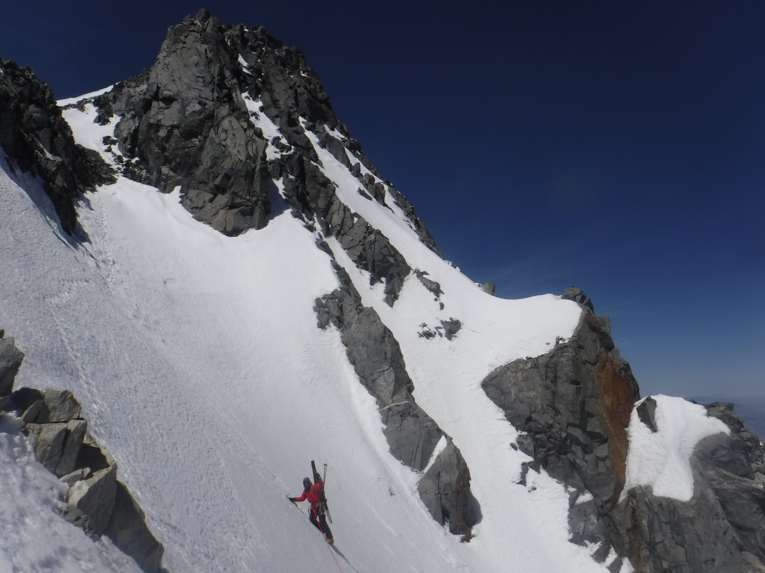
The couloir gains the ridge north of Whitney about 500’ below the summit. Guarding access to the final snow slope to the top was a fourth class rock step. After a little scouting we found a route through that felt secure, but definitely added some spice to the ascent. Past the rock step we climbed a few hundred feet of 50 degree snow to the summit plateau, then walked to the true summit.
Over the years I have learned that I seem to take longer to acclimate to new elevations than most people, and prior to this trip I hadn’t been much higher than 11,000 feet all winter. On our push to the summit I started feeling the wrath of moderate AMS, complete with headache, nausea, and fatigue. We enjoyed the summit for a few minutes, me through a haze of hypoxia, then made a quick transition to skis. The last snowfield we had climbed was steep with exposure below, so we sideslipped the chalky snow down to the rock step, down climbed back to the top of the couloir, then clicked in where the snow started again.
Survival skiing ensued. The snow in the couloir had fully refrozen, and the popularity of the route as a mountaineering objective had left the entire width of the chute filled with boot tracks. We hop turned and chattered our way down to Iceberg Lake, where the snow went into the sun again and we were rewarded with some good corn skiing.

East Couloir (Attempt), South Face, Split Mountain
The crux of any adventure on Split Mountain is likely driving to the trailhead. In my rear wheel drive van it took over an hour to travel just a few miles of rocky, washed out dirt road to reach the start of the hiking “trail.” Still trying to calm frazzled nerves, we went to bed early in preparation for our early wake up.
A few hours after leaving the trailhead Wade and I had arrived at the base of the East Couloir, our standard day packs having been made heavier by the addition of a rope, ice tools, and some rock and ice protection. Climbing the East Couloir involves a few pitches of moderate ice and, not having a recent conditions report, we were relying purely on optimism that the route would be in. It was not. Looking up from the base we saw that the typical ice bulge had melted into a narrow ribbon of rotten-looking ice.
Luckily, in reading previous trip reports we had learned that from the base of the East Couloir one can wrap around to the north side of Split Mountain and gain the summit that way. We were able to follow this route to the summit, but the wind had wreaked havoc on the upper 1000 feet of the north slope, leaving behind exposed rock and sastrugi. On the north summit of Split we considered our options, and agreed that picking our way down the north slopes didn’t seem very fun.
We also decided that we didn’t want to ski the East Couloir, as it looked like several portions that are typically skied had also melted out. Furthermore, we weren’t sure what our rappel anchors would look like, as the rotten ice made V-threads seem unsafe. We knew that the South Face of Split is a fun, steep, hourglass-shaped bowl, and we decided to traverse to the south summit to check it out.
To access the south summit from the notch between summits we had to climb a steep snow couloir with some exposed moves around a cornice at the top. Good thing we had climbing gear! It was nice to feel like we at least had a small reason for slogging a rope all the way to the top of Split Mountain. Wade led up through the few fifth class moves around the cornice, then belayed me up to the top of the South Face.
On the South Face, the springtime benefits of “Sierra Cement” made themselves fully apparent. The steep slope had been baking in the sun all day, and in most climates I am sure that avalanche danger would have been high at that point. But even with extensive ski cutting and pushing we couldn’t initiate anything more than a small slough. We skied lovely steep corn on the face down through the choke of the hourglass, then out the rolling terrain back to where we had left our shoes.
Giant Steps (Attempt), Super Bowl, Mt. Williamson
Giant Steps has a reputation for being hard to get to, hard to find, and a massive day however it is approached. By the time we were there the snowline had receded upwards of 8000 feet, and we heard from several sources that the most direct approach involves horrible bushwhacking if there isn’t snow down to the trailhead. We opted to start from the Shepherd’s Pass trailhead, which adds extra mileage and elevation gain, but compensates for that with easier travel.
The trailhead looked like a party. There were a half dozen trucks and a large group of people hanging out, eating dinner, and drinking beer when we arrived. Wade and I introduced ourselves to a few of them and learned that they were all patrollers at Big Sky on their traditional spring ski trip. We didn’t exactly know what to make of the scene, but did our best to make friends knowing that we were all going after the same objective the next day.
In the end, Wade and I underestimated both our new Bozeman friends and the scale of the day that we were attempting. The Big Sky patrollers were all crushers and, of the nine in their group, seven of them ended up skiing Giant Steps the next day, which I think is likely the most people to have ever skied that line in a single day. Wade and I arrived at the base of the West Face of Mt. Williamson, already having covered over 12 miles and 7500 vert, and decided that we didn’t have the legs to ski such a consequential line. As it was our exit skiing out Super Bowl would already add almost 2000 vertical feet to the day, and committing to Giant Steps would add nearly 3000 feet on top of that. We didn’t have it in us.
Skiing mellow corn snow out Super Bowl was a nice consolation prize, and we arrived back at the trailhead feeling grateful and humbled.

Bloody Couloir, Bloody Mountain and Mendenhall Couloir, Laurel Mountain
We next drove to Mammoth Lakes and met up with Wade’s friend Zach. We made plans to link up the Bloody Couloir, the last of our “official” classics to attempt, with the Mendenhall Couloir, which looked like it would be even more fun to ski than Bloody. We started at Convict Lake, skinning around and up the backside of Bloody Mountain.
When we reached the top of the Bloody Couloir the snow hadn’t yet softened but, due to our plans to link up with the Mendenhall, we felt obligated to drop in early. Complicating the situation we counted 20 people below in various places in the couloir (a perfect example of the “50 classically crowdedski descents of North America), all having taken the standard approach up the north side of the mountain. We decided to do our best to let people know that we were about to ski, but as we dropped in we definitely pelted some people with chunks of frozen snow dislodged by our skis. We felt bad, and also reasoned that anyone climbing a steep couloir with twenty other people around has accepted (or should have accepted) the hazard posed by those people in their decision. Regardless, we recognized that it was a moral gray area, and felt bad for any additional stress we caused for the people below us.
From the bottom of the Bloody Couloir we skied about a half mile down canyon to the base of Laurel Mountain. Upon arriving we saw that the slope we had hoped to skin up had been melted and wind-scoured down to the ground. Instead of an easy skin up a broad ridgeline we spent a fair amount of time trying to hike up loose scree in ski boots. Not quite what we had signed up for, but our commitment ended up being worth it.
The Mendenhall turned out to be one of my favorite lines I have ever skied. It descends for about 4000 vertical feet, and in that time remains just over 40 degrees from headwall to apron. It descends mostly fall line, with some small twists and turns that make the skiing more interesting. By the time we got there the snow was quite soft yet still stable, and we hooted our way down, leapfrogging from safe zone to safe zone. We skied out the apron directly to where we had left our shoes, capping off one of my favorite days I have spent on skis.

North Couloir, Red Slate
With one day left before Wade had to leave, we bucked our day on, day off pattern and made plans to finish our trip with one more classic line. Skinning up the backside of Bloody Mountain we had excellent views of the North Couloir on Red Slate, and it looked beautiful. We left the Convict Lake Trailhead at sunrise again and started walking. And walking. And walking some more. The approach to Red Slate felt way farther than it looked, but eventually we reached the base of the northwest slopes and started climbing towards the summit.
To ski the North Couloir directly from the summit requires making an exposed traverse on a steep, hanging snowfield. From the top we could see most of the traverse, but the last portion disappeared behind a rib of snow. There were also two sets of ski tracks that appeared to have made the traverse, so I decided to check it out. The turns off the summit were steep, but the chalky snow felt secure. Starting to traverse to skier’s left the aspect changed and the snow became more sun affected, alternating between slush and refrozen crust. Eventually I reached the rib that had blocked our view of the final portion of the traverse and found talus protruding through a thin layer of faceted snow. I slowly sidestepped through that section, but definitely felt like I was pushing it further than I would have liked.
Wade saw me reappear at the top of the couloir proper and, having seen how long it took me to traverse, decided to take the alternate entrance into the chute. Reunited at the top of the line, we leapfrogged down decent snow in the couloir to find perfect corn on the apron. By the time we had slid, skated, pushed, and walked back to the car we both had the contented feeling of having maximized our time in the Sierra. We felt like we had skied our brains out.

Looking Back
In backcountry skiing, and especially ski mountaineering, days when conditions line up perfectly feel fairly rare. And it is this rarity that makes those days feel all the more special when everything does come together. Having an entire trip come together like this one left me feeling spoiled, and I can only hope that I experience another trip like this in the future. Who knows, maybe the snow gods will make me pay for this with a season of facets, wind events, and breakable crust. Or, maybe they just decided to smile on us for ten days in the Range of Light.


Great journal article Brett! Ive climbed/skied a few times around Whitney. The ES are truly amazing….