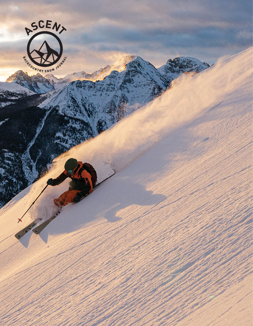
Photos by Drew Stoecklein
As far as the eye could see a realm of snow and rock lay stretched out before him, wrapped in the silence and mystery of the infinite. It was like being in another world; the mountains seemed less a part of this planet than an entirely independent kingdom, unique and mysterious, where, to venture forth, all that was needed was the will and the love– Gaston Rébuffat, On Snow and Rock
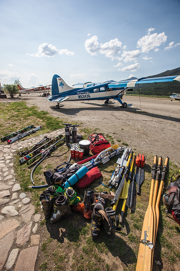
The hula-girl mounted above the dashboard of the de Havilland Beaver dances casually through the vibrations of the engine on the 1953 bush plane. Beyond the trinket and the windshield, Alaska’s remote Brooks Range begins to come into view. After months of research and a weeklong drive from Wyoming to Coldfoot, Alaska, we’re finally on the last leg of our trip, an hour and a half flight into the headwaters of the Noatak River. Loaded to the gills with skiing and rafting gear, as well as provisions for more than a month, there’s no backing out now. Despite our thorough research and credentials of similar trips, I couldn’t seem to shake the Gates of the Arctic National Park Ranger’s words from the week before, “Are you boys fucking stupid?”
The idea of the trip was simple: follow a snowflake’s journey from high atop a mountain peak all of the way to the ocean through the largest protected watershed on the continent. Essentially we’d become hitchhikers on earth’s circulatory system, schussing and floating our way over 400 miles through Gates of the Arctic National Park and the Noatak National Preserve, from source to sea. After months of meticulous planning, sleuthing out every bit of information we could about the massive Brooks Range, we came to the conclusion that the only way we’d know if the idea were possible would be if we tried. Although I remained confident that it was possible, and the trip looked amazing on paper, the pros and cons still ate away at me even on the final leg of our approach.
Then it happens. The jagged Arrigetch Peaks begin to pierce the horizon line, and I’m reminded of the photo that had seeded the idea in my mind from a 1980s climbing trip report I’d come across months ago. The old black and white photo hadn’t done the massive granite spires justice. Seeing these mountains in person, caked in spring snow, my anxiety began to ebb a little bit. Although we still had our work cut out for us, at least we had come for what we were looking for.
The plane touches down on an island in the middle of the Noatak and we quickly unload our gear. Our pilot wishes us luck and let’s us know, should we have any problems, he should be our first call. Without a hint of machismo one might expect from someone that makes a living flying around the Arctic Circle, he wishes us luck and takes off. Then, we’re alone. Ten days from the nearest people and surrounded by mountains that rarely see climbers, let alone skiers, we’re stoked, even if we’re still a bit nervous.
Along with me is my co-conspirator for the trip Drew Stoecklein. The Idaho-native is a born adventurer and has the endearing ability to piss you off and make you laugh, simultaneously. Lars Chickering-Ayers is a doer not a talker and the type of guy that is already taking on a task when you realize it needs to be done. The last member of our crew is Todd Ligare; a bit of a last-minute wild card whose primary qualification is his sheer enthusiasm for adventure.
After a brief council of war, we begin sorting gear for our first push into the mountains. The idea is to use the river and rafts as a sort of mobile base camp, and establish forward camps a bit closer to the snow. After months of planning and restless nights of sleep, with some luck, tomorrow, we’d be skiing.
—
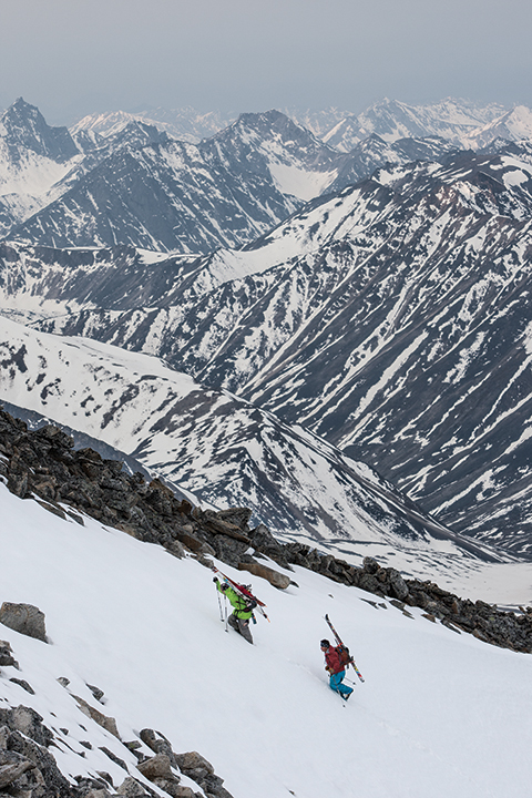
“I’m f#&?ing down climbing,” shouted Lars, responding to our questions about what he was doing. Standing just shy of the summit of our objective—an unnamed peak east of Aginuk Pass and a couple days walk from the rafts—we’d hit an impassable knife-edge consisting of loose scree, rock and ice. Although we all knew in the back of our minds that the section would likely force us to fortify to a sub-peak, it was nonetheless difficult to swallow after putting in so much effort. Reluctantly, we all begin descending 500ft of ice, snow and scree that we’d just so painstakingly navigated, to a lesser—although still worthy—couloir.
We’d finished the approach the preceding morning and we were quite pleased with the camp we’d established at the base of our objective. Touring around the area that afternoon, we determined the route up the backside of the peak, although less direct, would be safer and easier. Although the front side would have offered a more direct route and given us a better assessment of snow conditions, a large serac guarded a good part of the peak and created more hazards than we were willing to deal with.
That morning we had taken advantage of freezing temperatures and got an alpine start. Although we were dealing with 24-hours of light, there were still large enough temperature variations to create freeze-thaw cycles. The majority of the ascent went without incident, with Lars and Todd breaking trail up a several thousand-foot couloir that ran up the backside of the peak. As the snow thinned toward the top of the couloir, things got a little more interesting. Large pieces of scree, precariously balanced atop one another, began protruding through the snow. Travel instantly went from mindless to meticulous, making the last 500ft of the ascent particularly tiresome, and that much more insulting when we had to retreat.
Standing on top of a couloir we dubbed “Plan B,” the sense of frustration was all but gone. Sure, we didn’t get our original objective, but we had worked well as a team assessing a dangerous situation and making the right decision. There was no room for callous decision making out here and I was relieved there wasn’t a single cowboy in the group trying to push it.
We catch the snow just as it is transitioning from rock hard-ice to corn, and leap frog each other all the way down the couloir. At times we can see the Noatak winding its way through the lowlands thousands of feet below us and off into the horizon, seemingly providing a straight path from the couloir to the ocean. It’s a run months in the making and the first of many runs that will justify the anxiety of the past several weeks.
—
Several days later we still hadn’t put our skis back on. A storm had moved in after our first mission and had pinned us in our tent until our food ran low, forcing us to retreat back to basecamp. A little worn out yet undeterred, the weather finally began to cooperate giving us a window for our next push.
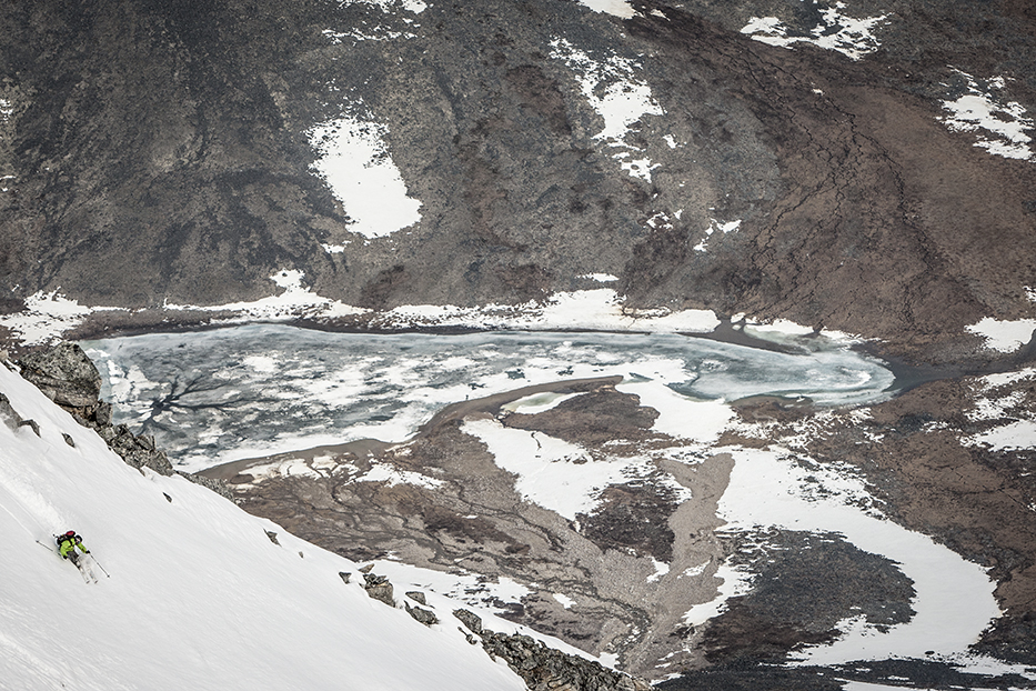
Our objective was a large peak visible from basecamp that loomed over the headwaters of the Noatak, about 5,000’ vertical from our camp. While it would be a long day, it seemed manageable. The approach started with a 2,300’ steep climb through thawed tundra that was nothing short of an early circle of hell. “It’s wet, it’s unstable, there’s a ton of mosquitoes—everything I hate—and somehow it’s uphill,” Drew would remark later. After an hour and a half slog we made it to a small mountain lake and got our first good look at the face we wanted to ski, and it looked amazing: 2,500 feet of sustained, 45-degree pitch, with intricate couloirs and cliffs throughout. Just what we’d been looking for.
Another hour and a lunch break later we were at the base of the face. Close up, the face had turned into a mess of runnels, debris piles, and water ice. The thunderstorms from the previous evening had turned what looked like a promising face into a hot mess. Although we felt deceived, as though we had mountain beer goggles on, we still racked our brains to find a way through. After much deliberation, we came to the conclusion that, although a strictly ski mountaineering descent was possible, the conditions were too unpredictable to continue up the face. We opted for a sub-peak that would be a little safer, but still offer worthy skiing.
We were about half way up a couloir leading to our new objective when we heard what sounded like a clap of thunder. Turning around to look for the source of the noise, we watched in a mix of horror and amazement as our original objective liquefied before our eyes. The snow on the face had reached a point of saturation that it had released like a slab avalanche. As Todd would later note, “it was a wet slide that you read about in books.” The amount of mud and rocks in the slide made it a landslide as much as anything else. Humbled, we pushed on, ever weary about the conditions.
We were relieved to find the sub-peak a little mellower and the snow more stable than our original objective. After painstakingly descending the most exposed part of the face we found ourselves in a large, natural halfpipe of compressed snow that skied surprisingly well. Wide, sweeping GS turns eventually gave way to the tightest slalom turns we could manage as we ran out of snow toward the base of the mountain. Feeling content, albeit a bit worn out, we swapped ski boots for hiking shoes and began the traverse back to camp.
We hadn’t made it far when we heard the first cracks of thunder. What we thought were isolated cells soon became a widespread electrical storm, which was about to engulf us. Looking like four lightning rods with our skis on our packs traversing across the barren hillside, we decided to ditch our packs, split up and curl up under whatever protection we could find. Sitting alone, waiting to be struck by lightning in the pouring rain as thunder boomed all around us, all I could think was, maybe that ranger was right.
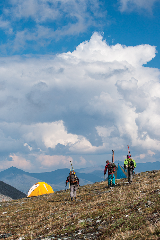
After about fifteen minutes of deep spirituality and self-reflection, the electrical storm passed and we were left with just pouring rain. We quickly regrouped and hustled toward the yellow dot of our tent that shined like a beacon of hope through the mist. It was around midnight when we finally made it into our tent and began to make dinner. Soaked to the bone, we were all relieved to be in the warmth of our tent, regardless of how tight the quarters were. We began to unwind from the epic day when Drew, who was cooking in the vestibule, suddenly unleashed a string of profanities, concluding with, “camp’s flash flooding.” Physically and mentally exhausted from the day’s events, this took a moment to register.
We all scrambled out of the tent to see, to our disbelief, the creek we had camped alongside exceeding it’s banks, the water rising quickly toward our tent, with the vestibule already in the newly formed channel. Although shocked, by this point in the trip the unexpected had become the norm and we robotically moved into action. We hastily gathered gear, by order of importance, and headed for higher ground. It was another hour before we’d moved several hundred pounds of equipment and were safely back in our tent. As we finally got to eat our food, we joked about the absurdity of the day and how, if there were going to be some sort of bear attack, it’d probably be tonight, the way things were going.
—
The idea of skiing and rafting seems like a brilliant one: rivers provide access and a means to transport hundreds of pounds of gear, allowing one to explore entire ranges relatively easily. By far the biggest danger on a trip like this is rafting on a river that is in the process of thawing. We’d gone through a lot of different “oh shit” scenarios, but by far the most threatening was the idea of running into an ice jam on the river that would force us to abandon our rafts and all of our gear.
It was with a mix of excitement and trepidation that we began our first full day on the river in search of our next objective. While we were generally confident that the river was clear, the icebergs that occasionally drifted by our boats, that at times were large enough to jump on and surf, gave us some cause for concern.
Despite the catastrophic thoughts looming in the back of our minds, floating down the river glassing the horizon for the next mission did provide a welcome relief from the constant sufferfest—which had become a typical day in the Brooks. It only took a handful of river miles to spot a promising zone: a snowcapped peak that looked surprisingly welcoming compared to the seracs and boulder fields of our last several missions.
After a leisurely evening at camp, we swapped life-vests for backpacks and once again began the slog through the thawed tundra. Misery is relative, and by this point we’d grown accustomed to wet feet, unstable hillsides and mosquitos the size of horseflies. The approach to the snowline took the better part of a day, but the crew had fallen into a rhythm of suffering, swearing and moving on–not exactly with Swiss-efficiency but we got it done nonetheless.
Our last day on snow was more similar to a leisurely spring day around a resort than a remote peak in the artic circle. We made several laps on near perfect corn, enjoying the setting as much as the snow. There was no sense of urgency and we casually chatted and joked as we transitioned from skis to skins and back again. As tired as we were, the sheer thrill of getting some proper skiing, and realizing a vision that was clouded in such uncertainty for so long, provided energy enough.
Clicking into our skis one last time we took in the panoramic view of the Noatak: stretching out to the east, the snowcapped peaks where we had our first epics and to the west, our final destination of the Arctic Ocean, some 400 miles downstream. Where we’d come from upstream seemed impossibly far away and our destination even further. But where we were right then, in that moment, seemed to be exactly where we were supposed to be, in the realm of snow and rock stretched out before us, wrapped in the silence and mystery of the infinite.
Griffin lives in Jackson, WY, where he refuses to use a boot with a walk mode. If you see him in the Park, be polite as you pass him on the skin track.

