By David Huebner
“For me, seeing the stark beauty and remoteness of the range in winter, with constant views of the snowy Sierra as if from an aircraft, rivals any mountain experience I’ve had in the greater ranges of the world.”
—Galen Rowell, High and Wild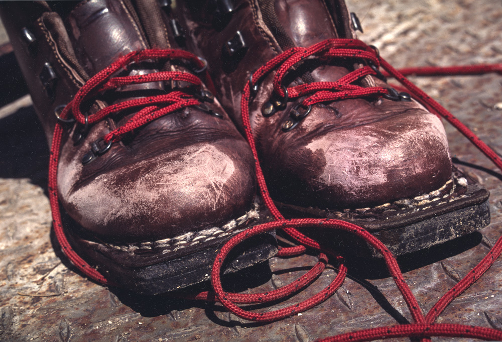
The White Mountains of California were first traversed on skis in February 1974 by a group of mostly Eastern Sierra residents: Jay Jensen, George Miller, Galen Rowell, and Dave Sharp. Their journey, thanks to Rowell, was sponsored by National Geographic, and included a flown-in food cache and use of the Barcroft Research facility. Jensen, Miller, and Sharp had tried the traverse before but had been stormed off twice, encountering ferocious winds and bitter cold both times. Prepared with new gear, two food caches, and use of the Barcroft facilities, they were able to weather two serious storms, one of which was the worst storm of the entire winter, lasting five days, and keeping them precariously tent-bound in 100+mph winds. When all was said and done, they had taken 16 days to complete the traverse. Ironically, National Geographic decided not to run the article because of the “lack of life-threatening circumstances.”
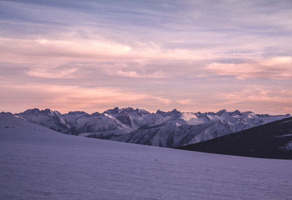
 Perhaps what the editors of National Geographic failed to understand at the time is that the crest of the White Mountains runs for 50 miles atop a hefty fortress of steep snow slopes, loose scree, sand, and talus, intermixed with impenetrable mountain mahogany groves, steep ridges of scattered bristlecone and pinyon-juniper forest and eventually some miles of sage and rabbitbrush leading into more miles of alluvial plain. The only roads are dirt and very rough. Almost none of the drainages are navigable on foot, leaving only the ridgelines as possible escape routes. To contemplate an exhausted, weather hampered, or injured descent off the crest is to certainly contemplate death.

Since the original traverse in 1974 very few have returned to complete the entire distance of the original trip. The main reason is an extremely variable snowpack, and bad weather allowing few good opportunities. And most of the trips that have attempted it started from the south and skipped both Boundary and Montgomery peaks since they aren’t exactly skiable along the crest, and involve some scrambling. Often a winter storm will clear, revealing a brilliant white wave of terrain that looks incredibly enticing, only to be followed by blasting winds that strip the entire range back to barren tundra.
The opposite of this occurred to a trio of Eastern Sierra locals John Dittli, Urmas Franosch, and Ben Grassechi when they attempted the traverse in June 1998 at the end of an enormous El Nino winter. With plenty of snow, and perfect corn, they planned for five nights to take advantage of possible descents along the way, and to ski among the ancient Bristlecone Pines. The snow was so good for the first couple of days that they thought they might immediately return afterwards with Nordic skate gear and go for a fast traverse.
But El Nino would not stop. As they set up camp on the summit of White Mountain, with their tent tied to the summit research building, a cloud bank began crawling in off the desert, a ‘Tonopah Low’, as it’s called around here—and that night it began snowing.
“It was 20 degrees and snowing with no wind.” John told me years later as we sat around cups of tea in his beautiful strawbale home outside Mammoth Lakes, California—a home he spent over a decade building himself. We look out the window from his dining room table and stare at the distant bowls pouring off White Mountain. “It dumped all night and all the next day—we got 18 inches.”
Once the storm cleared a decision had to be made, but there was really no decision to be made at all, the giant bowls pouring off the summit of White Mountain were coated in perfect dry powder with the snow line still roughly 4,000 feet below them.
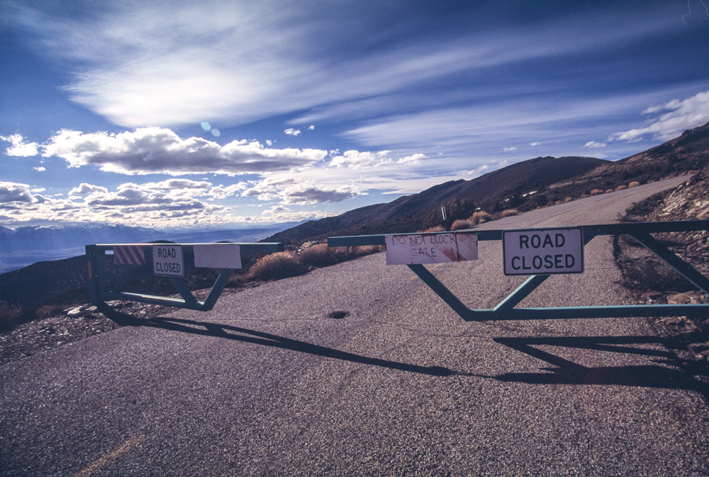
“We skied the Southwest Bowl first, “ John says, pointing at it out the window, “then we climbed back up, got our packs, and skied the Northwest Bowl.” I just shook my head looking out at those enormous, isolated bowls, which I’d coveted for years, and imagining them covered in fresh powder. There was one problem though—John had to be the best man at his friend’s wedding the following day. “White Mountain itself is really one of the few places you can bail off the traverse, because of the Jeffrey Mine—it felt Himalayan, coming down so far to those buildings, like coming upon a small village or something.”
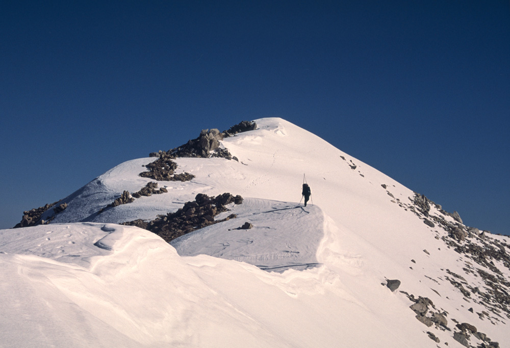
After years of waiting for the right snowpack, good conditions finally presented themselves in May 2005 and my good friend Todd Calfee and I headed out to attempt a two day traverse. We started from the north, the same as Rowell’s ’74 trip, with a steep climb to the summit of Boundary Peak, alternating between talus and bulletproof sastrugi. At the summit Todd told me he would be going no further. He was feeling sick, with a profound lack of energy. This wasn’t a total surprise as our other trip partner had already bailed due to illness, and it sounded like Todd was getting the same bug. I looked ahead towards Montgomery and beyond—the most involved ridge I’d ever attempted in winter conditions—and thought about how heavy my pack felt and how icy the snow was on the north side of the ridge. My mind also kept returning to a rabbit we’d hit on the road while driving out early that morning. Was it a bad omen? This would certainly be the most dangerous adventure of my life if I continued on alone. But there it lay before me, the sun was warm, and there was plenty of snow—the siren of the White Mountains ski traverse began ringing loudly in my ears…
I had to go.
I left some gear with Todd to lighten my load, waved goodbye and started along the gnarly ridge towards Montgomery Peak. The sunny side of the ridge was very soft, and the shady side was absolutely bulletproof, making route finding cautious and difficult. Once I negotiated my way to the top of Montgomery Peak, I began down the even more challenging south ridge—skiing most of it actually, but scrambling over jumbled rock in a few spots. The snow that had been in the sun all morning was getting way too soft, and triggering an avalanche was a real concern—at each horizon line I wondered what I’d find next.

It was with serious relief that I reached the saddle at the bottom of that ridge and began up the steep talus climb to The Jumpoff. I stopped and tried to snack on some food but lacked any appetite at all. My pack felt far too heavy and my nerves were going pretty strong. I just felt so completely “out there” and to be doing it alone had triggered a deep worry that I just couldn’t quell. It didn’t help that the wind was now howling in my ears so loudly it was almost impossible to think.
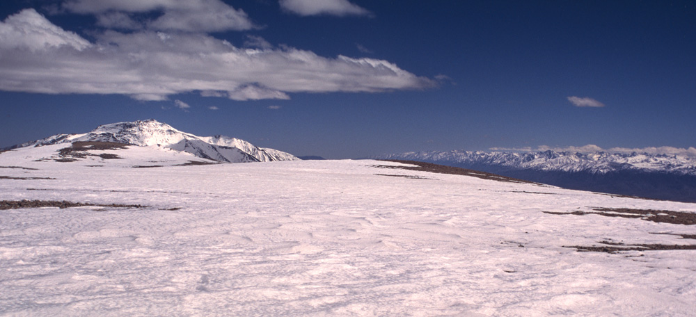
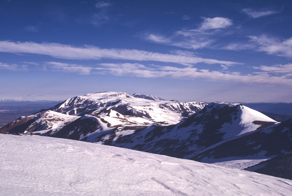
From the top of The Jumpoff, I happily began gliding across the eight-mile long, 13,000-foot high plateau of the Pellisier Flats. The Sierra Nevada stretched along the horizon for over 200 miles.

Alright, I thought, now for the good part! I breathed easier, set a steady pace and tried to enjoy the view. From the Pellisier Flats I could see north past the Sweetwater Mountains outside of Bridgeport, and south to well past Mt. Whitney—really the entire breadth of what is called “The High Sierra” was laid out in staggering scale. Through the insetting pain of a huge day, and growling howls of ice-cold wind, I allowed this Himalayan sized landscape to lift my eyes from my ski tips. This was the place that had so long held my attention. So many hours of silent pondering had been spent looking at this stretch of high, lonesome terrain. I don’t think there is any place quite like it on this continent—the Owens Valley, deepest in North America, the Sierra Nevada, highest in the Continental U.S., and all of it laid out in front of me in crystalline detail.

I linked some fun turns dropping off the Pellisier Flats, but towards the bottom the snowpack collapsed under my weight a couple of times sending me into sagebrush filled crud underneath. This was not a good sign, and I began to worry about the long southern end of the trip that would be at lower elevation, and perhaps even softer.

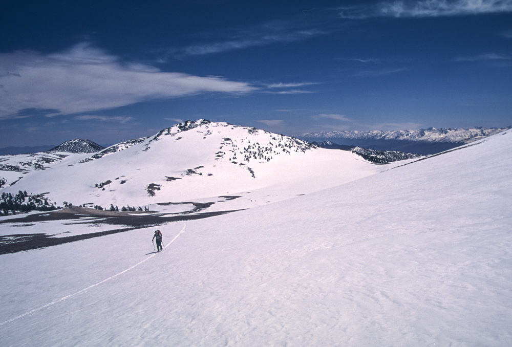
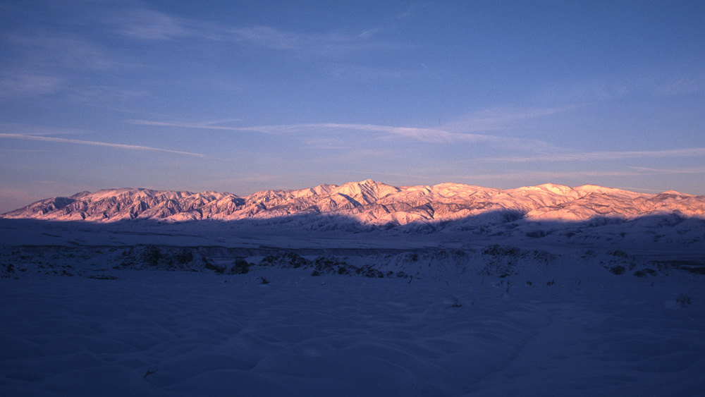
There is a prominent saddle at the head of Cabin Creek and Birch Creek, both carrying water down their respective sides of the range, and I headed down the west side to find open water and fill up my bottles since I was not carrying a stove to melt snow. My appetite was still almost nothing as I began the long climb towards White Mountain Peak. I’d hardly eaten anything all day. The sun dropped towards the Sierra casting everything in a magical orange and then pink glow. I found a spot to set my tent and settled in—worth every ounce to escape the tortuous wind. Looking over my maps that night I figured I’d gone some 20 miles with at least 8,000 feet of gain, all while carrying a pack that was not nearly as light as it should have been. I thought I would sleep well, but instead kept waking up throughout the night with nightmares of becoming too sick to make it further. Once the sun started to light the sky, I happily got moving again.

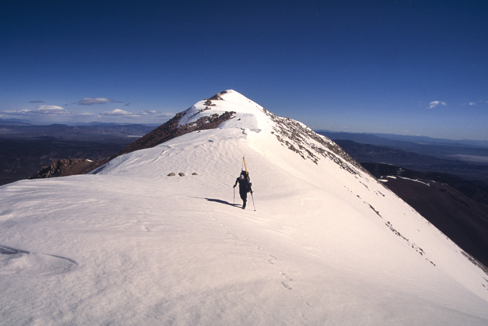
My leather telemark boots were frozen stiff, and the wind shoved me around more vigorously than before, almost knocking me over a couple of times. The north ridge of White Mountain Peak has a few class three spots in the summer and I was somewhat anxious about what its winter version would look like. Sure enough, a snow and ice filled knife-edge appeared in front of me. I could see no way of safely climbing it, especially considering the wind raking across it. As I got closer, I was beginning to get really worried. What would I do? Bailing off from this spot was not really an option. I continued to walk towards it even though it looked completely impossible and suddenly I noticed a narrow snow chute led down off the east side of the ridge into a steep bowl. The bowl looked traverseable so long as the snow was soft enough to hold an edge. There was literally no other reasonable choice, so I sideslipped into the bowl, and began a high, precarious traverse directly beneath the rocky crest. The snow had softened in the morning sun just enough to make it possible but it was dicey holding an edge on the 45 degree slope with my leather lace-ups and narrow waxless touring skis. A mistake or slip could likely send me rocketing down the bowl. Slowly and steadily I worked my way across and over to a saddle on the other end of the north ridge. I couldn’t believe my luck. From there it was only a matter of minutes before I was huddled against the shelter of the stone summit building on White Mountain Peak—the high point of the traverse.
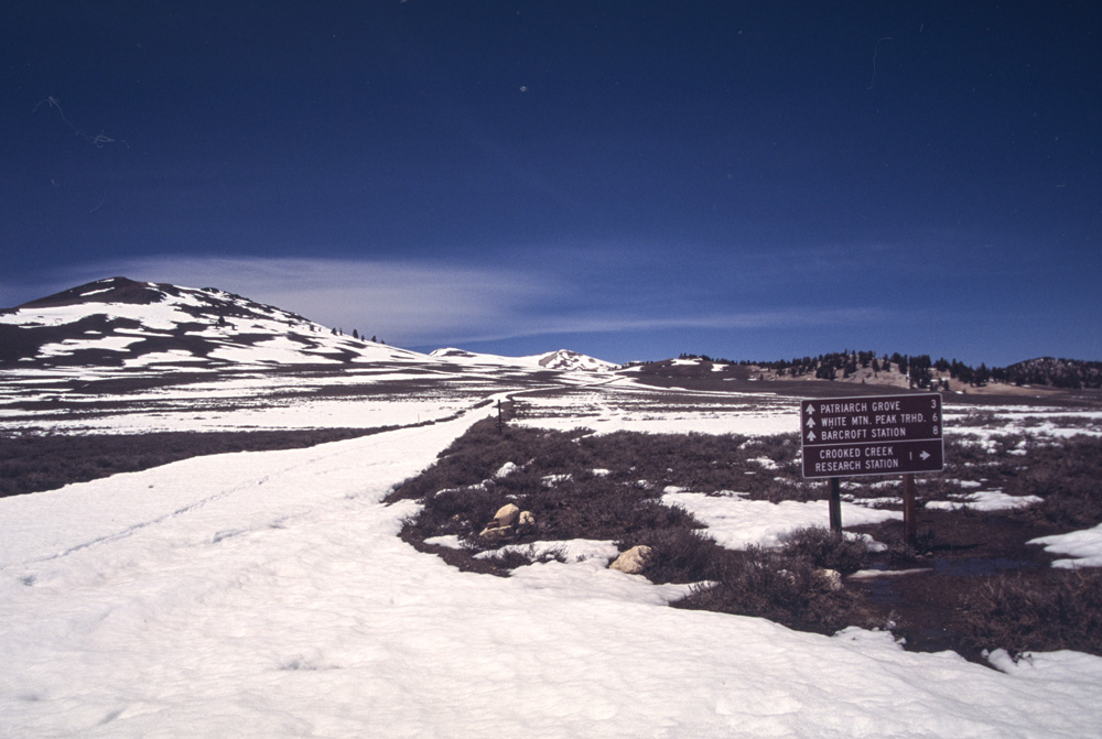
The stone building is a high-altitude research laboratory operated by the University of California (UC), originally built in 1955. At 14, 246’, it is the fourth highest lab in the world, and the highest of the three labs operated by the UC in the White Mountains. Five miles away is the Barcroft Lab at 12,500’, and several miles from that is the Crooked Creek facility at 10,150 feet. With these three labs, it seems to me that there has likely been more research work done in and about the White Mountains than any other range in the country. One of the major results of study in the White Mountains is the greatly improved accuracy of radiocarbon dating, or carbon-14 dating, which came about from the study of the dendrochronology of ancient Bristlecone Pines in the White Mountains.
Our understanding of Old World prehistory owes much to these trees. Uncalibrated carbon dating had reinforced theories of cultural diffusion spreading outward from Mesopotamia and the Fertile Crescent, but with the Bristlecone chronology used as a calibrator, artifacts in Europe were actually found to be older than previously thought, and completely disrupted the convenient theory that ‘civilization’ began and spread from one source. The oldest still-living Bristlecone, “Methusela”, is 4,767 years old, and by finding ever older overlapping dead snags and remnants of snags, a climate record of nearly 9,000 years has been established, with ongoing study hoping to push that record another thousand years.
The study of tree-rings (dendrochronology) has been around for over a century, but it came to the forefront of public attention in the 1950s with Edmund Schulman’s discovery of the Bristlecone Pines in the White Mountains. Schulman found that in fact the Bristlecones were the most ideal species for tree-ring study because of their harsh living conditions. This hardship produced very sensitive, responsive rings (closer together in times of drought, wider in times of moisture), and the trees turned out to be the longest lived in the world.

As I huddled against the snow-drift wrapped research lab on the summit, trying hopelessly to eat a dried up bagel and sip on ice cold water, I couldn’t resist looking for those familiar forested hills that mark the “Schulman Grove”—out there, just beyond those hills of ancient trees sat Todd’s truck, and my salvation.
Needless to say, I didn’t stay long, and soon began skiing down the frozen slope off White Mountain, chattering towards the rolling fields that would lead me past the Barcroft Lab where Galen Rowel and his friends sought shelter during their 1974 traverse. The snow actually got soft enough that I had the best turns of the trip off Sheep Mountain south of Barcroft, but that glorious glide soon gave wave to the hideous sensation of collapse as I repeatedly plunged down into an ever worsening snowpack. My leather boots began to absorb water with each rotten collapse, and they became fierce battering rams upon my toes and feet. With many miles yet to go, I entered into a World of Pain.
There is not much I can say about the following miles. It is all a delirious, hazy, dream-like memory. I had to keep going, and there was no good snow I could go upon without collapse. The miles seemed endless. So many faceplants, so many close calls with buried shrubs and rocks. So much PAIN.
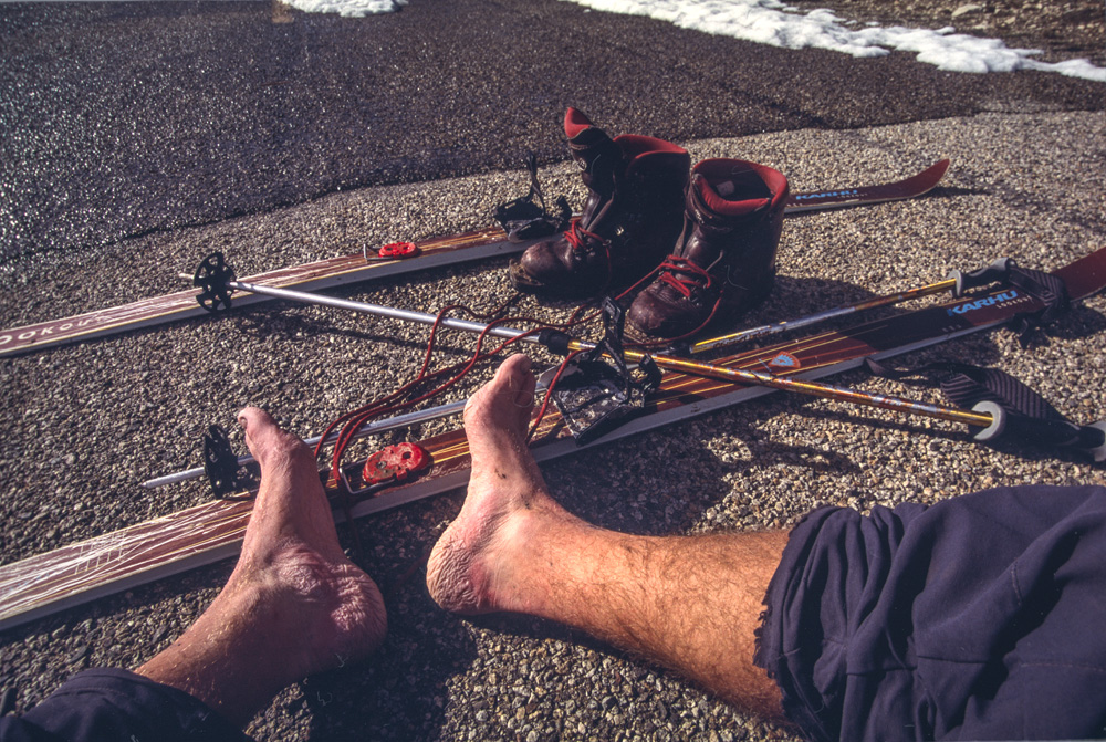
I could barely walk when I finally reached the pavement at the Schulman Grove. The road was plowed, but the gate was still locked two miles away at Sierra View, where Todd’s truck was parked. I pulled off my battering ram boots, and pulled on the only other footware I had—goose-down booties. By this point it was hot, and the afternoon sun was baking down on me, but my poor feet needed that tiny sliver of padding those booties had to offer. I began limping slowly down the road, with the Sierra gleaming back at me in all its glory. I couldn’t help but smile at this scene—such a grand and dangerous traverse finished by limping down the road in a pair of puffy black booties!! I felt like the whole Sierra Nevada mountain range was laughing at me, you ski-bum Homer, lured by the siren of the White Mountains!

When I reached Todd’s truck at Sierra View it felt anti-climactic, and surprisingly emotionless. I sat down in the drivers seat and turned the ignition. I was ready to go home. The last long miles of torture I’d just endured left little to be proud of other than I had not died. And, in fact, looking at the clock on the dash of the truck, I’d completed the traverse far faster than I’d expected: I’d started late, around 7:00 am the morning before to cross a distance of 50 miles with over 10,000 feet of gain, and arrived at the truck just before 5pm the next day—34 hours or so. No wonder I was tired.


do you think there has been a splitboard traverse of the whites? trying to plan a tour there have some questions